blah blah blah
The Bluff
Length: 5.4 miles out-and-backDifficulty (click for info): Moderate
Elevation Gain: 970 feet (+40 feet on return)
Rating (click for info): 6/10
Elevation: 2285'
Driving Directions:
Trailhead and parking area are on Rt. 16 in Greens Grant, NH (summit is in Thompson and Meserves Purchase). Look for the entrance to the parking area on the west side of the road, 6.3 miles south of the junction with Rt. 2 in Gorham and 1.5 miles north of the entrance to the Mt. Washington Auto Road. Pull into the entrance, marked by a recreation sign for the Great Gulf Wilderness. Drive through an upper lot wtih extra parking, and look for parking in the lower lot, where the drive forms a loop. The trails take off from the far left corner of the loop. Click here for a Google map.
About the Hike:
Drivers on the Mt. Washington Auto Road may not realize that just to their right as they motor toward the summit visitor center, museums, and cafeterias is over 5500 acres of some of the most wild and rugged landscape in New Hampshire. The Great Gulf is one of the state's five federally-designated wilderness areas and concealed in the bottom of the deep and spacious glacial cirque careening down from the summits of Washington and the northern Presidentials are a plethora of scenic delights. The central feature of this valley is the West Branch of the Peabody River, which forms many breathtaking waterfalls on its journey down from the headwall of the gulf. The trek into the Great Gulf becomes progressively more rewarding the further you go, revealing glimpses of monolithic mountain walls, scenic views up boulder-filled streams, and more of these stunning waterfalls and cascades. The hike seems to become progressively more difficult as well the further you go, as you add on more distance and the valley floor becomes more rugged as you weave through boulders above the riverbank, climbing up in altitude. If you make it all the way to the end, you'll come face to face with one of the most incredible mountain scenes in New Hampshire as you view the amphitheater of the gulf's main headwall, strewn with enormous boulders and ledges, from the peaceful and remote shores of Spaulding Lake, where the elevation surpasses the summits of all but the 35 highest mountains in all of New England. This abbreviated version of the full grueling hike will give you just a taste of the incredible wilderness scenery in exchange for a much easier outing. Your turnaround point will be "The Bluff", an interesting viewpoint from atop a boulder that provides a unique view into the more remote areas of the gulf and the mountains rising all around. For the full hike through the gulf, see The Great Gulf
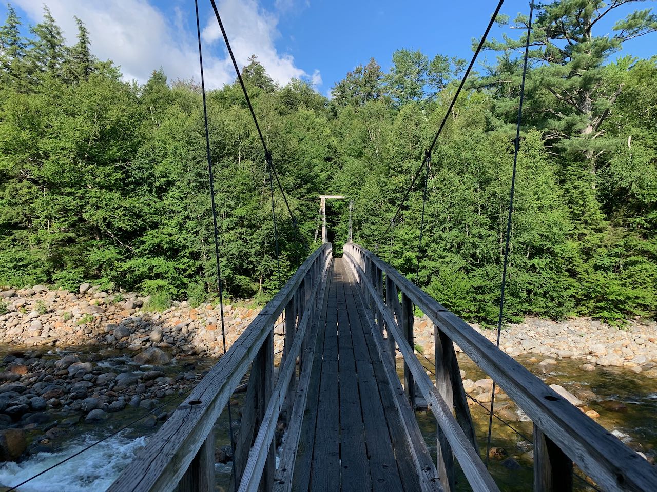
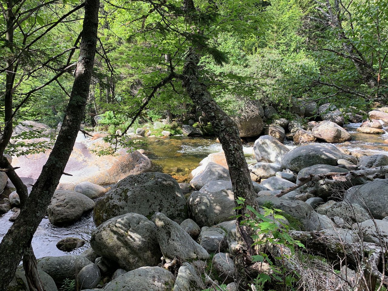
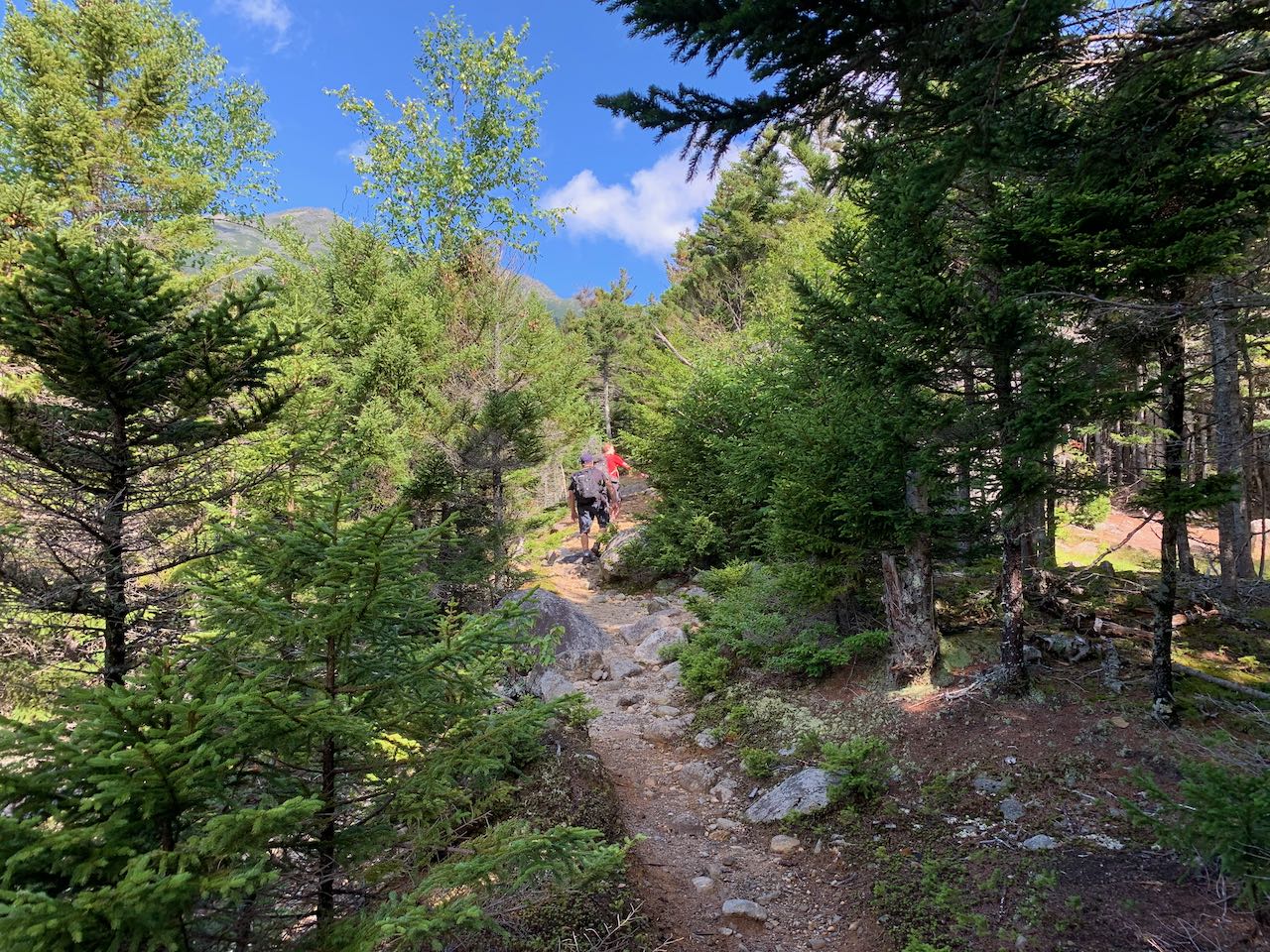
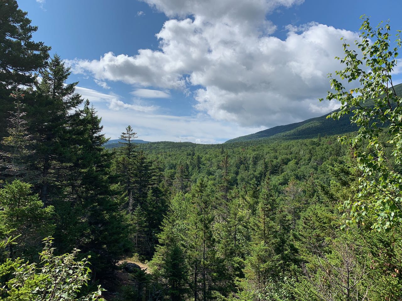
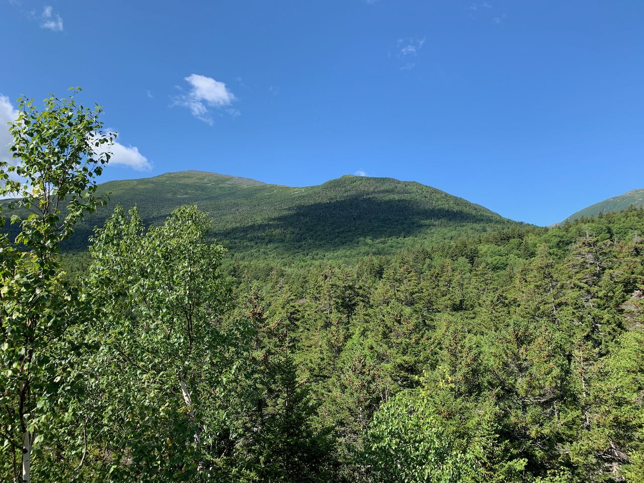
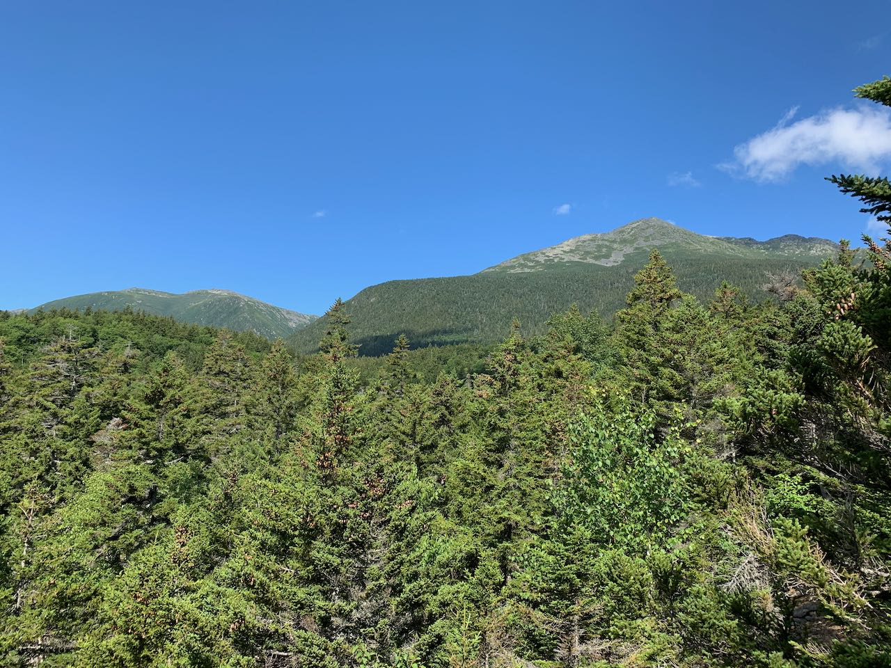
From the information kiosk at the lower end of the parking area, walk down the paved path along the river to the suspension bridge. Cross the bridge and get your first look at the rocky river that will be your on-and-off guide through out the hike. Drop down the stairs off the bridge and climb uphill for a bit to reach a junction with Great Gulf Link at 0.3 miles from the start. Bear left and walk along a smooth surface with just a few roots underfoot from the dark hemlocks surrounding the trail. In this section, the trail doubles as a cross-country ski route. The river remains close by on the left. In another 0.3 miles, bear left as the trail detours around a muddy section of the ski trail. The path narrows and runs rough just atop the riverbank, with rapids and little cascades below, crossing one little stream. It then begins to pull away from the river. Passing by a swampy depression, it runs straight through a hobblebush corridor to rejoin the ski trail after 0.4 miles. The trail ascends gently, crossing a couple streams on wide wooden bridges built for skis (these can be slippery in the summer). In 0.6 miles, the trail passes a ski trail junction and immediately after crosses the boundary line into the Great Gulf Wilderness, marked by a sign. With a rockier surface on the trail, continue 0.2 miles, passing a large boulder, to the next trail junction, where the Osgood Trail takes off to the right. The trail now begins to approach the river again, climbing through mossy rocks along the base of an increasingly steep hill. 0.6 miles past the junction, the trail comes out to an opening right beside the water, where you have the opportunity to explore around the boulders in the river. Just beyond this, the trail climbs a steeper pitch up the bank away from the river. At the top of a rock staircase, it moderates and continues climbing with a couple flat sections to emerge in the gravelly clearing at the top of The Bluff, 0.3 miles from the river. You'll get a glimpse of the high mountaintops as you approach the top. Where several campsites exist across a grassy clearing, scramble up to the top of a boulder on the right side of the trail to see the best view. Over the trail to the left, you can just see the top of the Wildcat Mountain Ski Area. Across the valley from you rises the form of Chandler Ridge, which carries the Mt. Washington Auto Road. Off on the right side, you can see where the interior of the Great Gulf wraps around the corner, although you can't see into the valley floor. Mt. Jefferson overlooks this portion of the gulf, while the triangular summit of Mt. Adams is closer on the right side of the view.
Printable directions page